
Homewood ZIP Directory Coverage
Homewood's verified postal picture is small but not simple. The strongest ordinary residential evidence points to 35209, which appears on municipal and library addresses across central, older, and West Homewood. Samford University supplies a second confirmed role. Its campus is geographically in Homewood, yet its official mailing line uses Birmingham 35229. Two other nearby ZIPs often appear in general descriptions, but the available official sources do not prove their exact overlap with incorporated Homewood.
That evidence calls for a coverage table with confidence labels. It does not support filling gaps with common map-site claims. The post office column also describes a postal facility, not a legal boundary.
| ZIP | Verified Homewood role | Post office or mail line | Boundary note |
|---|---|---|---|
| 35209 | Central, older, and West Homewood; used by City Hall and the library | HOMEWOOD Post Office and Green Springs station serve the area | The postal area extends beyond the city |
| 35229 | Samford University campus | Samford's official line says Birmingham | Confirmed institutional and postal mismatch |
| 35216 | Possible southern or eastern overlap | Nearby Vestavia and Birmingham geography | Confirm each parcel and mailing address |
| 35226 | Possible western or southwestern overlap | Nearby boundary geography | Not confirmed as a Homewood-wide sector |
No Homewood PO-box-only ZIP, official split year, or full current ZIP-to-city overlay was verified. A box service at a post office does not make the whole postal area box-only. This Homewood postal directory therefore separates confirmed roles from candidates.
Homewood Records in 35209
The clearest local oddity sits at the named Homewood postal facility. The USPS Homewood Post Office listing places the facility at 2710 18th Street South but labels the address Birmingham, AL 35209-1904. Its phone is 205-871-0641. Retail hours are Monday through Friday, 8:30 a.m. to 5:00 p.m., and Saturday, 9:00 a.m. to 2:00 p.m.; PO boxes are accessible around the clock.
The same postal zone is used with Homewood as the city label at official municipal sites. City Hall and Homewood Public Library both use Homewood, AL 35209. That difference is normal postal behavior. It shows why a preferred mail city cannot establish city taxation, council representation, school assignment, or police jurisdiction.
The USPS address and ZIP lookup is the right first check for a delivery line.
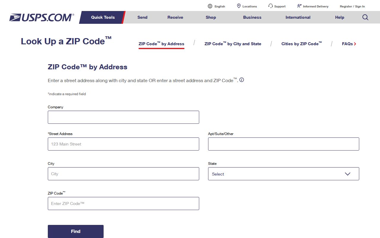
The lookup verifies postal formatting. County and city records must still answer the jurisdiction question that the mailing line leaves open.
Samford's Homewood ZIP Mismatch
Samford University is a precise example of the ZIP-versus-city distinction. The campus lies within Homewood, while the university's official address at 800 Lakeshore Drive uses Birmingham, AL 35229. That makes 35229 a documented institutional delivery geography for Homewood. It does not prove that a broad ordinary residential slice of the city uses the same code.
Institution records also need their own interpretation. A campus mailing address can show an affiliation or delivery point, not a private residence. Samford's catalogs, yearbooks, newspapers, and archives are valuable for historical affiliation research, but none turns the institutional mail zone into a list of current Homewood residents.
Note: Keep the 35229 finding tied to Samford unless an address-level USPS and county parcel check supports a wider Homewood claim.
Candidate Homewood ZIP Records
Codes 35216 and 35226 appear near Homewood, Vestavia, Birmingham, and Hoover boundary areas. Yet no authoritative current overlay in the research confirms exactly where either code intersects incorporated Homewood. A sound postal directory cannot promote a candidate to a firm coverage claim just because it appears on a generalized web map.
Check a representative address in two systems. USPS establishes the deliverable postal line. The Jefferson County parcel service exposes municipality, premises address, subdivision, legal description, and situs ZIP fields. If city service or permit authority remains unclear, ask Homewood directly. This sequence preserves what each source can prove and avoids treating a Census ZCTA, which is only a generalized statistical shape, as a USPS delivery polygon.
Search Homewood Residents by ZIP
No verified public portal produces a complete Homewood resident roster from a ZIP alone. CAPture has name, parcel, mailing-address, and property-address modes, but no documented ZIP-only search. VoterView checks one known voter through name, birth date, and a CAPTCHA. It cannot browse a postal area. A purchased Alabama voter list may include residence and mailing fields, yet it still omits minors, nonvoters, and some protected records.
A postal-area search is therefore a narrowing process, not a one-click list:
- Use the official USPS tool to normalize a known address and confirm its delivery code. Retain the original address wording in case public records use an older form.
- Open the parcel in Jefferson GIS. Confirm the municipality, parcel ID, premises ZIP, subdivision, and legal description rather than relying on the postal city.
- Search CAPture Real Property by property address for the assessed owner and parcel detail. Ownership does not establish every occupant.
- For voter research, use Alabama VoterView only for a known person, or request the authorized voter file and work with the address fields supplied.
- Once the area narrows to a named road, use the Homewood street directory for address-level work.
The purchased-file channel begins with the Alabama voter-list request form. It asks for requester contact details, geographic scope, active or inactive status, selected data, delivery medium, file format, and sort choice. Residence and mailing information may both be selected where available. Ask for an address-based sort, then group the delivered rows by premises ZIP rather than assuming the state offers a public ZIP search. Do not prepay. The Secretary of State quotes the cost before payment and can deliver by mail, email, or pickup. The form routes by mail to Attn: Jeff Elrod, P.O. Box 5616, Montgomery, AL 36103, or by fax to 334-242-2444; questions go to 334-242-7210 or 800-274-8683.
Each result should retain its source date and role. Postal delivery, assessed ownership, voter registration, and actual occupancy are different facts. A purchased list is not a census and must be handled under Alabama election law.
Homewood ZIP Fields in Records
County parcel data carries two ZIP concepts. The situs field belongs to the premises. The owner mailing field, shown as ZIP_MAIL in the GIS schema, belongs to the destination for tax correspondence and may point outside Homewood or outside Alabama. Mixing them can produce a false local list.
CAPture exposes address modes rather than a postal-code filter. Its documented controls show how to reach the parcel that contains the useful ZIP fields:
| Search field | Type | Required | Homewood use |
|---|---|---|---|
| Name | Radio choice and text | Choose one mode | Enter last name, then first |
| Parcel number | Radio choice and text | Choose one mode | Remove spaces and punctuation |
| Mailing Address | Radio choice and text | Choose one mode | Search the owner's correspondence line |
| Property Address | Radio choice and text | Choose one mode | Search the physical premises |
| Tax Year | Dropdown | Default supplied | Check the year attached to the result |
Open View Details after a match. A mailing and property address that agree can support an owner-occupancy inference, but they still do not name every person at the home.
Postal Lines and Homewood Limits
Four geographic layers answer four different questions. USPS confirms deliverability and the preferred postal line. Jefferson GIS supplies parcel-based municipality and administrative fields. Census incorporated-place data describes the statistical city boundary. A ZCTA approximates ZIP geography for statistics but is not a live delivery boundary.
Near an edge, a Homewood permit or service question may still require contact with the city. Parcel geometry also comes with an as-is warning and is not a legal survey. These limits do not make the records useless. They show why two independent systems are needed before attaching a household or parcel to Homewood.
Boundary check. Use USPS for mail, Jefferson GIS for parcel municipality, and Homewood for city services; never make one label answer all three questions.
Homewood ZIP Directory Terms
Postal and county terms can look alike while describing distinct systems. A short glossary keeps Homewood directory results in the right lane.
- ZIP and ZIP+4
- A ZIP groups delivery geography. The added four digits narrow mail to a smaller segment, building, or delivery point.
- PO-box ZIP
- A code reserved mainly for post-office boxes. No such Homewood-only code was verified.
- Unique ZIP
- A code assigned for a high-volume organization. Samford's 35229 evidence shows an institutional mail pattern, though no formal unique-ZIP designation was verified.
- Carrier route
- A postal delivery path within a broader code. It is not a city ward or parcel boundary.
- Situs ZIP
- The code tied to the physical property address in county parcel data.
- Mailing ZIP
- The code used for owner correspondence, which may be far from the parcel.
Keep these labels in separate columns when taking notes. That small step prevents an owner's out-of-area correspondence code from being counted as a local premises code.
Legal Land Anchors Homewood Records
Postal labels can change while land identity remains traceable. Homewood grew from Rosedale, Grove Park, and Edgewood in 1926, added Hollywood in 1929 and Oak Grove in 1955, and later expanded into West Homewood. Older directories and deeds may therefore use a predecessor community or county precinct rather than a modern city name.
The Rosedale record also documents street-name changes. Park Avenue became Montgomery Highway and then 18th Street South. Tenth Street became 26th Avenue South. When a modern ZIP or street label fails, use the parcel number, subdivision, block, plat book and page, and legal description. Those fields bridge postal shifts without inventing a citywide renumbering rule that the official sources do not provide.
Note: A legal description identifies land, while a ZIP code routes mail; neither one alone proves who currently lives at the address.