
Homewood Previous-Resident Source Eras
The right starting source depends on the date under study. Current assessment data identifies the parcel and assessed owner. Recorded deeds extend the ownership chain. Directories and the census add household snapshots, while maps and permit files explain changes to the structure or address. The table keeps verified coverage separate from gaps. It does not turn an undated source into proof of continuous occupancy.
| Source | Years it covers | Where held | What it shows |
|---|---|---|---|
| CAPture assessment roll | Current interface and selected tax year | Jefferson County BOE and Tax Assessor | Assessed owner, situs, mailing, parcel and value |
| LANDMARK index | 1987 to current, Birmingham Division | Jefferson County Probate | Named recorded transfers and instrument references |
| LANDMARK images | 1993 to current, Birmingham Division | Online portal | Recorded instrument images |
| Courthouse land records | County custody since 1850; older material into the 1800s | Birmingham Record Room | Pre-digital ownership chain, deeds, maps and plats |
| Homewood-explicit directories | 1941-42; 1949-60; 1974, 1980, 1988-90 | Birmingham Public Library and microfilm | Dated listed householders, spouses, addresses and work clues |
| Federal census | Public through 1950 | Library and archival databases | Named household snapshots by census date |
| Birmingham Sanborn atlas | 1911 atlas verified | Library of Congress | Structures, street and block numbers; exact Homewood sheet must be confirmed |
| Homewood permit files | Coverage start not published | Inspections and City Clerk request | Address-specific construction or alteration events |
For recent previous residents, start with CAPture and a current acquisition deed. For an older Homewood household, establish the land identity first, then select directory and census years that bracket the period. Where the online deed run ends, continue at the Birmingham courthouse rather than borrowing the Bessemer Division's earlier cutoff.
Begin with Homewood Parcel Records
Search the address in Jefferson County CAPture using Property Address, then open View Details. Save the parcel number, assessed owner, situs, owner mailing address, subdivision, legal description, and any plat references. The displayed parcel number should remain in the research log even though a new CAPture search removes its spaces and periods.
Next, compare the parcel in the authoritative county GIS layer. Check municipality, situs ZIP, neighborhood or subdivision, legal description, and parcel ID. That step matters near postal and city-label mismatches. The owner mailing address is only the destination for tax notices. A matching mailing and situs address may support an owner-use clue, but neither form lists everyone who lived there.
The legal description is the bridge into the past. Street labels can change. Postal lines can vary. The described lot, block, subdivision, and plat make it possible to test whether an old deed and a current Homewood address refer to the same land.
Note: Keep the record year beside every parcel detail, since a current roll must not be projected backward onto an earlier household.
Trace Homewood Deed Records
A backward title chain starts with today's assessed owner and a confirmed legal description. A grantor is the party conveying an interest. A grantee is the party receiving it. The chain of title is the linked sequence of recorded interests in the same land. It tracks ownership, not every occupant.
Use LANDMARK WEB and proceed in this order:
- Search the current owner as grantee and find the acquisition instrument that matches the subject legal description.
- Record grantor and grantee names, deed type, execution and recording dates if shown, instrument number, book and page, and full legal land description.
- Search the confirmed seller as grantee to locate that party's earlier acquisition of the same parcel.
- Repeat the comparison. Follow referenced estate, trust, foreclosure, corrective, merger, or quitclaim instruments when the simple chain breaks.
- At the online cutoff, bring the Birmingham Division, names, approximate dates, and book-page or instrument details to the Record Room.
- Grantor and grantee
- The party giving an interest and the party receiving it in a recorded instrument.
- Chain of title
- The linked history of recorded interests in the same land.
- Legal description
- The land wording that identifies a lot or tract more reliably than a changing street address.
- Directory snapshot
- A publisher's dated listing, which may identify a householder without proving ownership or a full household.
A same-name deed party elsewhere in Jefferson County is not enough. Match the legal description every time. Probate staff provides records but does not perform the chain or give title advice.
Cross Homewood's Digital Records
Homewood uses Jefferson County's Birmingham Division. The online index begins in 1987, while images begin in 1993. That creates a six-year span in which a name and instrument may appear online without the image. Earlier Birmingham land records remain courthouse material and can extend into the 1800s. The Bessemer web index reaches farther back, but that is the wrong division for ordinary Homewood land research.
Jefferson County Probate Archives describes ongoing preservation of old land, map, and marriage material. Digitization has not replaced the Record Room. LANDMARK itself is a courtesy index, not the official record. Search and watermarked viewing are available to unregistered users; printing calls for registered access under the published tiers.
The distinction can change a conclusion about previous residents. An online gap may mean the needed image sits at the courthouse, not that no transfer happened. Prepare before visiting because county parcel computers may have short sessions and daily folder limits.
Monitor Homewood Deed Records
A finished ownership timeline can still change. The Jefferson County Property Fraud Alert signup lets a researcher monitor a personal or business name used in later recordings. Registration asks for the name type, the name and confirmation, and an email address with confirmation. Separate alerts may be useful for spelling variants or an entity name that appeared in the deed chain.
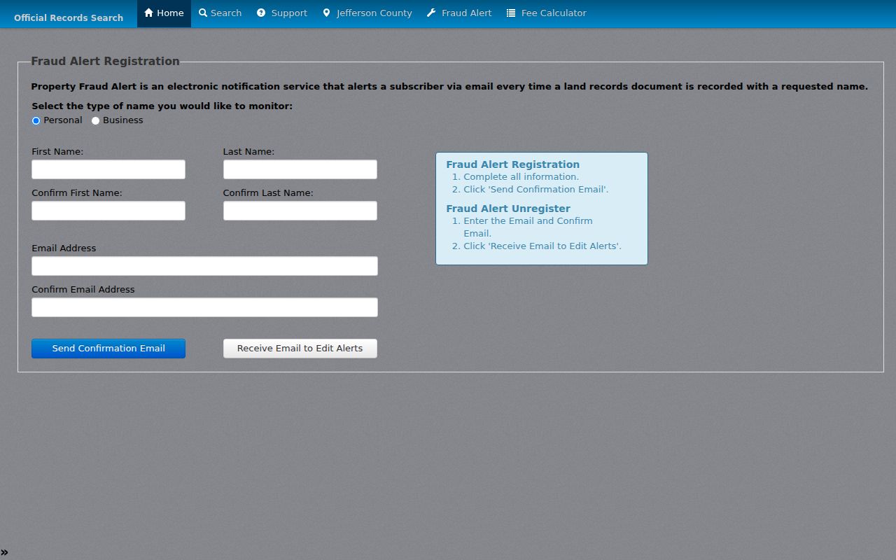
The alert sends notice after a matching instrument records. It does not block a filing, validate the document, insure title, or watch only one Homewood parcel. When an email arrives, inspect the recorded instrument in LANDMARK and contact Jefferson County Probate if the name match appears wrong or suspicious. The service is a timely check on a documented ownership trail, not another source of past household names.
Trace Homewood Past Households
Deeds name owners. Listed householders and family members require other evidence. Homewood often appears inside Birmingham or Birmingham-suburban directory titles rather than a stand-alone run. Verified Homewood-explicit editions include 1941 and 1942, a rich sequence from 1949 through 1960 with gaps noted by the catalog, and suburban editions from 1974, 1980, 1988, 1989, and 1990. Broader Birmingham reels extend from 1888 through 1992 with gaps, but each early volume must be checked for the target community.
For the collections themselves, consult the Homewood city directories page. When tracing one address, use this shorter process:
- Choose a directory year within the confirmed ownership period and inspect that edition's contents and abbreviation key.
- Search the surname and its spelling variants. If present, use the street or householder section to test the civic number.
- Transcribe the printed name, spouse text, address, occupation, employer, cross-references, and edition year without filling blanks.
- Bracket a missing year with the prior and next available editions, then compare the public 1930, 1940, or 1950 census when the dates fit.
- Use employer, spouse, church, and street details to distinguish same-name households, then return to deeds for ownership.
Birmingham Public Library's physical collection is reference-only at Linn-Henley Research Library and uses weekday appointments. Homewood Public Library adds onsite Ancestry, JCLC databases, local histories, bound municipal minutes, and clipping files. ADAH supplies the digital Homewood collection and a county-record microfilm catalog. These channels fill different gaps without turning any one catalog into a complete address index.
The public census is a decennial snapshot through 1950. Directory coverage and census boundaries were built for different purposes, so disagreement can reflect geography rather than a move. Write “not listed” instead of “not living there” when an edition yields no entry.
Repair Homewood Street-Name Breaks
Homewood's record geography predates the city. Rosedale, Grove Park, and Edgewood combined in 1926. Hollywood joined in 1929, Oak Grove in 1955, and later acreage became West Homewood. A prior resident may therefore appear beneath a predecessor community, county precinct, or Birmingham publisher label even when the parcel now lies inside Homewood.
The official Rosedale study supplies a verified address concordance: Park Avenue became Montgomery Highway and then 18th Street South; 10th Street became 26th Avenue South. It also shows why a directory trail can look like a move when only the street label changed. No complete Homewood renumbering list was found, so extend these examples only through legal descriptions, plats, maps, and the exact documents for the parcel.
The ADAH-hosted Homewood digital history collection provides local source material for checking community and street context.
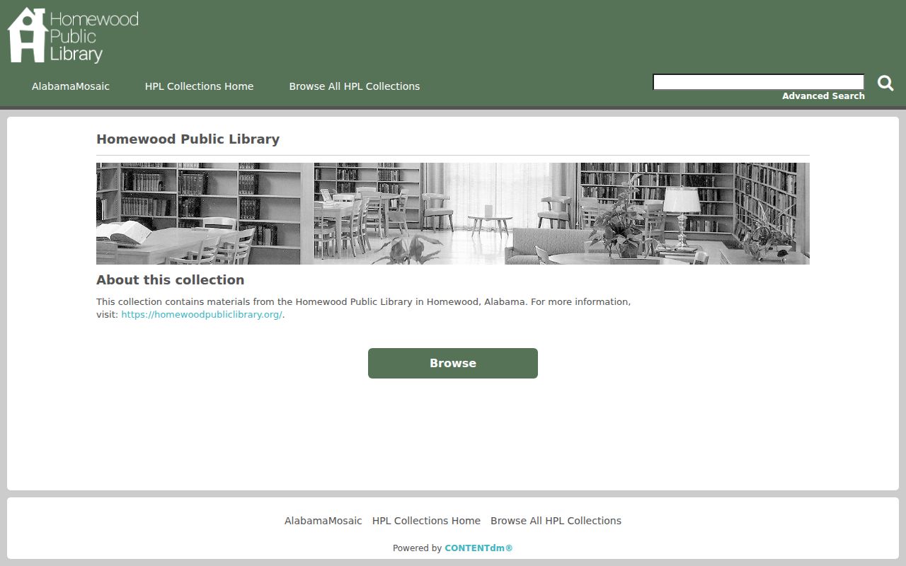
That community archive helps interpret a historical address, but it is not a live occupant roster. Tie any person back to a dated directory, census line, deed, newspaper, or probate record before adding the name to a house timeline.
Map Homewood Previous-Resident Evidence
The Library of Congress 1911 Birmingham Sanborn atlas can show building footprint, construction material or use, lot lines, street width and name, house or block numbers, and fire infrastructure. Yet the title “Birmingham” does not prove that a specific Homewood predecessor address appears on a given sheet. Confirm the sheet and old place name before treating it as property evidence.
Digitized Birmingham telephone directories for 1926-27 and 1928-30 also include Homewood entries. They can bridge a narrow early period, but a phone listing is not the same as a full household or a deed. Compare the printed street and surname with the directory, census, and land chain.
Homewood Inspections & Permits handles building permits, certificates of occupancy, code files, and several trade inspections. No verified public address-index endpoint or coverage start was found. Call 205-332-6800 or send a narrow request through the department or City Clerk with the address, permit type, and date range. A permit can date construction or alteration and may name an applicant, contractor, or owner. It does not prove residence.
Note: Maps explain how a place changed, while permits document a city event; neither source should silently add an occupant to the address.
End Homewood Resident Trails
A person's disappearance from a directory can reflect death, a move, a missing edition, a surname change, or a publisher omission. Newspapers and probate help test those paths. Birmingham Public Library holds the Birmingham News from 1889 forward, the Post and Post-Herald runs, the Age-Herald, and African American newspaper runs including Birmingham World and Birmingham Times. Its Southern History department also maintains an obituary index.
Search around a move, death, marriage, church appointment, school event, or business change. Use the old address and occupation as disambiguators. An obituary may identify relatives or heirs. Jefferson County Probate Judicial files can establish personal representatives, estate roles, and filing-date addresses. Estates remain open at least six months, but no public estate-name portal was verified. Ask the courthouse with a name, approximate date, and known address or relationship.
For a remote library request, provide one specific name, edition or newspaper date, and address. The Birmingham Public Library Southern History service states that specific-copy requests normally receive a response within 48 hours. Its research fee is $5, emailed PDFs are available, and mailed copies add the stated per-page and postage costs. Staff does not undertake a full family history.
Obituary and estate evidence should close a known person's trail, not prove uninterrupted occupancy. An address in a petition belongs to the filing date.
What Homewood Records Cannot Prove
Previous residents are not identical to past owners. A deed records an interest in land. CAPture identifies an assessed owner. A directory lists selected people in a given edition. The census records a household on one enumeration date. A permit identifies an event and role. Even when these sources agree, state the dates and evidence rather than claiming a person occupied the address for every day between them.
Renters and other occupants may never appear in land records. A person can vanish from a directory because the issue is missing, the household was omitted, or the area fell outside the publisher's run. Historical street labels can create a false move. Utility customer files were not found as a public index, and commercial compiled profiles can retain stale or merged data.
Lawful use. Research previous residents for house history, family history, heirs, or personal curiosity. Never use an address trail to stalk, harass, intimidate, or harm a living person.
A good Homewood address history preserves uncertainty. It distinguishes “not listed” from “not present,” ownership from occupancy, and current contact from an old filing address. Those limits keep the backward trail useful and fair.